Capture the Erie Canal
200 years in Wayne County
Main Exhibit Open May - November


Don't miss the boat!
You have got to see the Erie Canal.


1825-2025
Timeline Major Events and Achievements
1817 - 1825 Construction begins on July 4th and continues until the inaugural first complete trip on October 25th.
1847 - 1862 First enlargement increases lock size and canal width and depth. Route changes in some areas. Irish immigrants are employed in large part for this expansion.
1908-1918 Second enlargement increases size of canal, reduces the number of locks and canalizes rivers. Towpath is eliminated in favor or steam or petroleum powered boats.
Canal-Related Events
Erie Canalway Heritage Corridor
_______________________
October 25 - Deadline to submit items for the Community Exhibit. Open Exhibit. Read about it here.
November 4 - 22 - Community Exhibit - Capture the Canal: A Creative Tribute to the Erie Canal
Special Thanks to these amazing
Erie Canal researchers, historians, and local advocates.
Bob Stopper and the Lyons Canal Greeters
Roger Hotel and Historic Palmyra for Lock 60 diorama.
Craig Williams, Board VP of Canal Society of NYS
Steve Talbot, creator of Erie Canal Story Map
Bill and Greg Lesher, creators of Erie Canal Mapping Project
Allyn Perry at the old Poor House Lock #56 and former canal grocery house.
Steve Wunder and Bucky Lauster
NYS Canal Corp employees at Lyons Dry Dock, Lock 28a and Lyons, Lock 27
Zakk Hess, Wayne County GIS Coordinator
Jane Milem, Wayne County Historian
Stivers Marina and Finger Lakes Water Adventures
The Lyons Hotchkiss Peppermint Museum
Capture the Erie Canal: 200 years and 35 miles in Wayne County
Join us this year to honor the legacy, the majesty, and resiliency of the Erie Canal.
The Erie Canal was the "super-highway" of the 19th century. This 363-mile, manmade waterway carried goods and people from NYC to Buffalo and beyond, to populate what was then the western reaches of a new nation. It also carried much needed raw materials and finished goods back to what soon became the largest marketplace port in America, New York City.
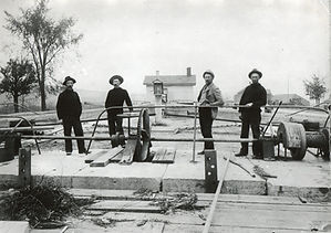
This 4-ft deep, 40-ft wide "ditch" changed the course of natural waters and the subsequent history of New York State, of the United States and yes, even of Wayne County, New York. With a total of three sometimes divergent routes, the ditch was carved by hand and mule, across the state, and enlarged twice.
Wayne County is home to 35 miles of the canal waterway and another 30+ miles of the official Erie Canalway Trail which travels over much of the same route as the original towpath. The towpath was laid out for the "hayburner" mules and drivers "hoggees" which pulled the commercial laden barges and passenger packet boats. Steam engines and tugs were required by 1918, which ended use of the towpath.
There are five major town centers along the canal system, and each one unique in it's connection to the canal. From the west, Macedon has Lock 30 just north of their downtown, at the Canalside Park and Butterfly Trail.
Next, Palmyra is known as Queen of the Canal with a small dock and historic district that touts an original canal depot. Passing through widewaters (and a sliver of Ontario County known as Port Gibson), next is Arcadia's Village of Newark which is investing in a beautiful canal side district and amphitheater.
Lyons, the county seat, has one of the last "urban" locks (#27) within the old village limits and the nearby Peppermint Museum. Galen's Village of Clyde too has invested in their canal park called Lauraville Landing just west of Lock 26, near the location of the original canal lift bridge.
The most eastern town center of Savannah is further north than the route of the canal, but it shares the southern border of their town with the canal as it passes through the Montezuma wetlands heading toward the world famous, Richmond Aqueduct and the Seneca-Cayuga canal that connects boaters to the Finger Lakes.


STILL SO MUCH TO DISCOVER
There are many reasons why the Erie Canal was so important to our reason. This massive 19th century public works project changed these very small local towns into bustling town centers.
Unfortunately, the native American population of the Iroquois and the Haudenosaunee were impacted by the influx of so many settlers.
Immigrants and local farmers together were employed to survey and to dig such the ditch. Many families stayed to operate it once it was open.
The other Northern Wayne County towns also benefitted by getting their agricultural products to market quicker, cheaper and profitably.
The waterway was a path for freedom seekers to safer havens along the banks of Erie Canal and on to Niagara, Sodus, and other Lake Ontario ports.
Religious and social revivals were a common undercurrent of the local culture.
The Museum of Wayne County History will attempt to capture the essence of the Erie Canal in our community. We will tell you who dug it and show you some of the tools they used. We will explain to you the three different, sometimes quite divergent paths of the canal, and we will celebrate the recreation and the artistry that has followed the canal into the 21st century.

